


Geraldton wave data
Find out about wave data at Geraldton, including current (real-time) and historical wave directions, and significant wave heights.
Geraldton sea and swell directional graph
The bearing of the arrow indicates the direction of the sea and swell. The point of the arrow indicates the period of the sea and swell.

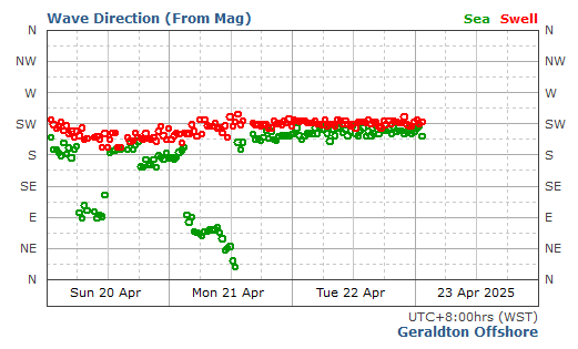
Geraldton historical wave direction graph
The coloured circles indicate the changes in sea and swell direction over time
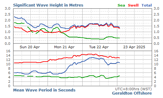
Geraldton significant wave height graph
The significant wave height is the average height of the highest one third of waves recorded. It is often the wave height reported by an experienced observer
About wave data
The wave climate at any location can be, and usually is, a combination of sea and swell and is often referred to as the total wave.
The graphs below provide information on sea waves and swell waves. They are updated as near to real-time as possible.
The near real-time wave data is downloaded from recording sites and graphics created for the web using software developed by Tremarfon Pty Ltd.
All data provided is subject to the Department of Transport's Disclaimer, conditions of use and copyright policy