Repair works
Several areas of the harbour were impacted following ex-tropical cyclone Narelle earlier in 2026. Repairs are underway, however, there may be some temporary disruptions. We apologise for the inconvenience and are taking all reasonable steps to minimise disruption to harbour users, nearby businesses and the community.
View notice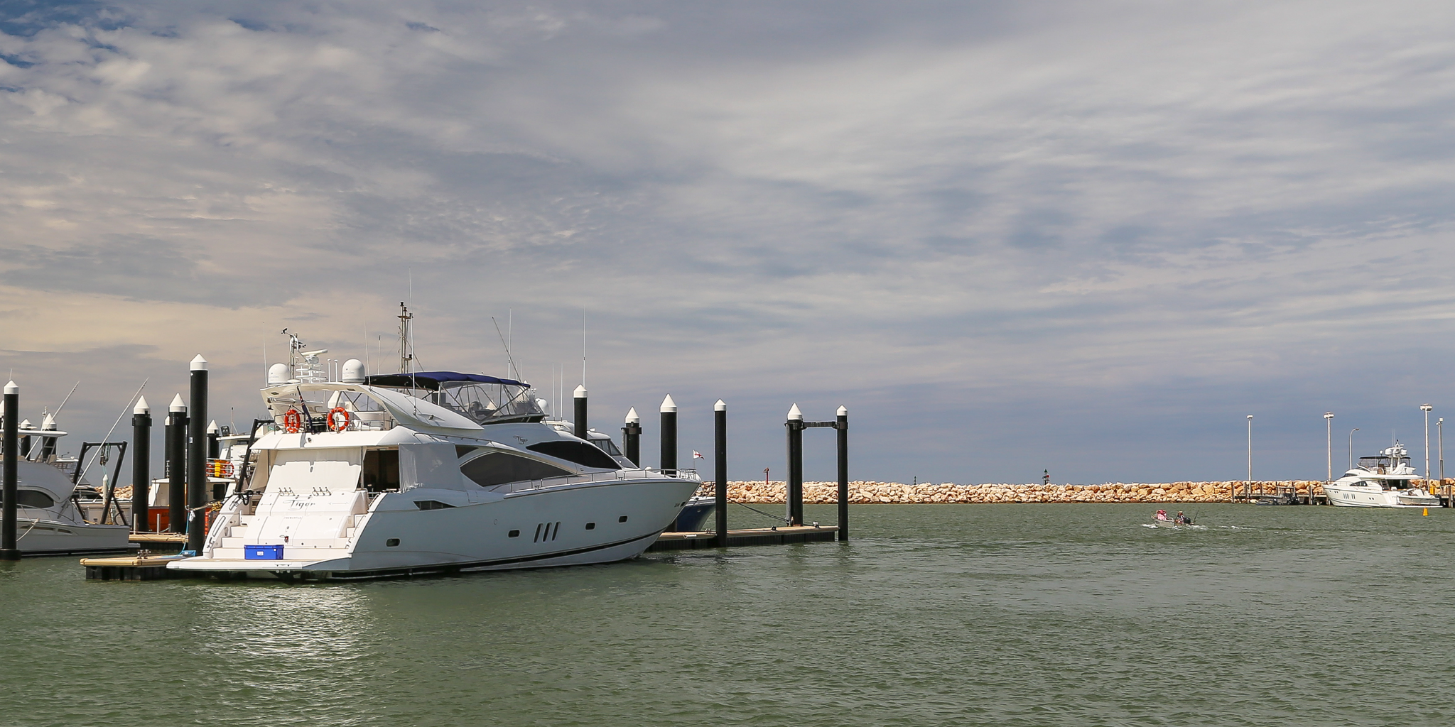
The Exmouth Boat Harbour is located approximately two kilometres south of the Exmouth town centre and stretches across 5 hectares.
The boat harbour is a busy commercial hub that supports the local fishing, charter and recreational industries, as well resources projects in the region.
The boat harbour provides a range of safe vessel accommodation options for commercial and recreational vessels. Boat launching, refuelling, and fish cleaning facilities are all available.
Exmouth Boat Harbour is the northern gateway to the World Heritage-listed Ningaloo Marine Park, famous for stunning turquoise waters, diving and snorkelling where you can see whale sharks, manta rays, humpback whales, turtles and brightly coloured tropical fish.
Find out more about the masterplan to develop and improve Exmouth Boat Harbour.
Harbour facilities
Service wharf
The service wharf provides single and three phase power, water, lighting and refuelling facility.
Wharf load limits
Old service wharf
- Berth load: 820 tonne displacement vessel berthing at a maximum of 0.2 m/s at a maximum approach angle of 15°
- Stack load: 760 kg/m²
- Crane load: 30 tonne hydraulic truck crane with 9 tonne lift at 8 metre radius.
- Vehicle load: Total 44 tonne gross.
New service wharf
- Berth load:
- side berthing of 850 tonne displacement LCT vessel berthing at a maximum 0.25 m/s with a maximum approach angle of 15°.
- side berthing of 300 tonne displacement platform supply vessel berthing at a maximum 0.25 m/s with a maximum approach angle of 15°
- side berthing of 130 tonne displacement trawler vessel berthing at a maximum 0.3 m/s with a maximum approach angle of 15°
- Stack load: 15 kPa distributed load.
- Crane load: 30 tonne mobile crane operating at maximum outrigger load of 18.1 tonne.
- Vehicle load: Total 44 tonne gross.
Heavy lift wharf
- Berth load:
- side berthing of 850 tonne displacement LCT vessel berthing at a maximum 0.25 m/s with a maximum approach angle of 15°.
- side berthing of 300 tonne displacement platform supply vessel berthing at a maximum 0.25 m/s with a maximum approach angle of 15°
- side berthing of 130 tonne displacement trawler vessel berthing at a maximum 0.3 m/s with a maximum approach angle of 15°
- Stack load:
- 40 kPa distributed load.
- 20 foot sea containers 1 high in clusters of 4.
- Crane load: 150 tonne crane operating at maximum outrigger centres with a maximum outrigger load of 79 tonne.
- Vehicle load:
- T44 truck or 3 x 12 tonne axles representing semi-trailers.
- container forklift with maximum front axle of 90 tonne.
Fuelling facility
Diesel is available on the service wharf. Fuel is provided by Baileys Marine Fuels Australia and 24 hour access is available with Baileys Marine Fuel Card.
Phone: 1300 224 539
Email: baileys@ampol.com.au
Boat ramp
A dual lane recreational boat ramp is located on the north side of the boat harbour with sealed car and boat trailer parking. Recreational boaters should be aware that the pens surrounding the boat ramp are used by large commercial vessels.
Fish cleaning facilities
There is a fish cleaning table with water and waste disposal bins.
Parking
There are 2 sealed public carparks located to the north of the boat harbour.
Toilets/showers
A toilet and shower block for penholders is located near the charter boat pens. Not open to the public.
Expired flare disposal
Flare disposal is available nearby at the Department of Transport and Major Infrastructure (DTMI) Exmouth office, 21 Maidstone Crescent, Exmouth. Find out more about flare disposal locations.
Waterways, harbour and entrance channel
Latitude: -21.957 S
Longitude: 114.143 E
Harbour basin and entrance channel area depth: 2 metres below chart datum
The harbour bed at the existing pens can become exposed at low tide. Based on basic astronomical conditions the tidal range at the harbour is approximately from -0.4 metres to 5.9 metres.
Breakwaters
There are three breakwaters to protect against wave penetration into the harbour.
Boat pens
Number of pens
62 pens
Pen lengths
Options include:
- 10x 12m pens
- 1x 13m pen
- 1x 14m pen
- 6x 15m pens
- 28x 20m pens
- 3x 24m pens
- 4x 25m pens
- 1x 20m CAT pen
- 1x 15m CAT pen
- 1x 12m CAT pen
- 4x 25m trawler pens (south side of harbour)
Services
Single and three phase power, water, lighting and toilets and showers located nearby.
Fees and charges (2026/27)
See below for current fees at Exmouth Boat Harbour.
Fixed, floating and 25m pens are charged per metre of pen length. The fixed and floating alongside berths are charged per metre of the vessel length.
Recreational, tourism, government and fish vessel accommodation fees
12 months
| Fee description | Amount |
|---|---|
| Fixed pen with walkway | $606.40 |
| Floating pen with walkway up to 20m | $758.00 |
| 25m pen with walkway (tropical cyclone zone) | $1,212.80 |
| Fixed alongside berth | $606.40 |
| Floating alongside berth | $758.00 |
3 months or more per month
| Fee description | Amount |
|---|---|
| Fixed pen with walkway | $55.30 |
| Floating pen with walkway up to 20m | $69.15 |
| 25m pen with walkway (tropical cyclone zone) | $110.65 |
| Fixed alongside berth | $55.30 |
| Floating alongside berth | $69.15 |
1 month
| Fee description | Amount |
|---|---|
| Fixed pen with walkway | $90.95 |
| Floating pen with walkway up to 20m | $113.70 |
| 25m pen with walkway (tropical cyclone zone) | $181.90 |
| Fixed alongside berth | $90.95 |
| Floating alongside berth | $113.70 |
1 week
| Fee description | Amount |
|---|---|
| Fixed pen with walkway | $27.25 |
| Floating pen with walkway up to 20m | $34.10 |
| 25m pen with walkway (tropical cyclone zone) | $54.55 |
| Fixed alongside berth | $27.25 |
| Floating alongside berth | $34.10 |
Service vessel accommodation fees
12 months
| Fee description | Amount |
|---|---|
| Fixed pen with walkway | $833.80 |
| Floating pen with walkway up to 20 m | $985.40 |
| 25m pen with walkway (tropical cyclone zone) | $1,212.80 |
| Fixed alongside berth | $833.80 |
| Floating alongside berth | $985.40 |
3 months or more per month
| Fee description | Amount |
|---|---|
| Fixed pen with walkway | $76.05 |
| Floating pen with walkway up to 20m | $89.90 |
| 25m pen with walkway (tropical cyclone zone) | $110.65 |
| Fixed alongside berth | $76.05 |
| Floating alongside berth | $89.90 |
1 month
| Fee description | Amount |
|---|---|
| Fixed pen with walkway | $125.05 |
| Floating pen with walkway up to 20m | $147.80 |
| 25m pen with walkway (tropical cyclone zone) | $181.90 |
| Fixed alongside berth | $125.05 |
| Floating alongside berth | $147.80 |
1 week
| Fee description | Amount |
|---|---|
| Fixed pen with walkway | $37.50 |
| Floating pen with walkway up to 20m | $44.30 |
| 25m pen with walkway (tropical cyclone zone) | $54.55 |
| Fixed alongside berth | $37.50 |
| Floating alongside berth | $44.30 |
Service vessel use of pen with walkway or alongside berth
| Fee description | Amount |
|---|---|
| per day, per metre of the vessel length | $13.85 |
Other facility fees
| Fee description | Amount |
|---|---|
| Electricity supply - metered | COST |
| Water supply - metered | COST |
| Rubbish removal - including any not placed in supplied bins or containers not removed; waste oil in excess of 150 litres; or rubbish from source other than fee paying vessel. | COST |
Service vessel use of a wharf or service jetty
| Fee description | Amount |
|---|---|
| Use of service wharf, per 6 consecutive hours or part thereof - per metre of the vessel length | $10.65 |
Find out more about the fees and conditions for using our service jetties and wharves.
Apply for a boat pen or harbour mooring
DTMI’s vessel accommodation is offered on a casual, short term and long term basis and is always in high demand. Submit the enquiry form to find out if a pen is available.
Ready to apply?
Once you have spoken with one of our Harbour Officers to confirm availability, fill in either the waitlist or vessel accommodation application form below and familiarise yourself with important terms and conditions.
Weather and conditions
Before heading out on the water, be sure to check the current:
Bureau of Meteorology (BOM) resources:
Useful resources
DTMI has several resources to help you stay safe when out on the water.
Cyclone community information sheet
This information sheet provides important information to help users of Exmouth Boat Harbour during the lead up, impact and recovery from a tropical cyclone.