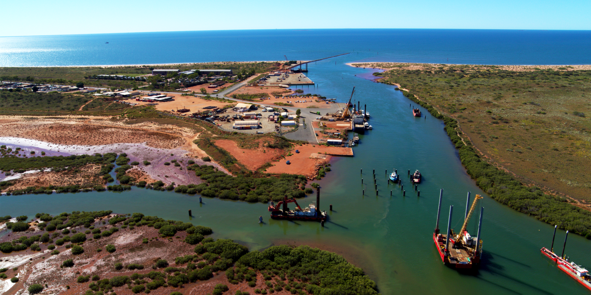
Onslow Beadon Creek Maritime Facility is located approximately 550 metres south of the entrance to Beadon Creek.
The main users of the facility are the resources sector and recreational, fishing and charter vessels. There has been extensive growth of oil and gas projects in the region and the facility has become a supply base for offshore operations.
The facility comprises of 8 pile mooring pens, a service wharf, dual public boat ramp, fuelling facility, as well as a fish cleaning table and public car park.
Find out more about the development of the Onslow Community Boating Precinct at the Onslow Beadon Creek Maritime Facility.
Service wharf
The 50 metre service wharf provides single and three phase power, water and a fuelling facility.
Wharf load limits
- Berth load: 50 tonne displacement vessel berthing at a maximum of 0.3 m/s at a maximum approach angle of 15°
- Stack load: 750 kg/m²
- Vehicle load: M9 standard load
Fuelling facility
Fuel is available from the service wharf. This service is provided by Baileys Marine Fuels and a fuel card is required.
Phone: 1300 224 539
Email: baileys@ampol.com.au
Boat ramp
The Onslow Community Boating Precinct provides users with a dual lane boat ramp, all tide access floating jetty with more than 40 metres of berthing space on both sides.
Fish cleaning facilities
There is a fish cleaning table located near the boat ramp.
Parking
There is a public car and boat trailer park next to the boat ramp with solar lighting
Waterway entrance channel
Latitude: -21.646 S
Longitude: 115.131 E
The entrance to the Onslow Beadon Creek Maritime Facility requires regular dredging.
Refer to the Cyclone Community Information Sheet – Onslow Beadon Creek below for more information on the dredged depths.
Boat pens
Number of pens
8 pile moorings (The Sticks)
Pen lengths
8x cyclone rated for up to 20 metre length
Fees and charges (2026/27)
See below for current fees at Onslow Beadon Creek Maritime Facility.
Moorings, berths and service wharf use fees are charged per metre of the vessel length.
All fees quoted are inclusive of GST and should be paid in advance.
Recreational, tourism, government and fishing vessels - pile moorings
| Fee description | Amount |
|---|---|
| 12 months | $303.20 |
| 3 months or more per month | $27.65 |
| 1 month | $45.45 |
| 1 week | $13.60 |
Recreational, tourism, government and fishing vessels - fixed alongside berth
| Fee description | Amount |
|---|---|
| 1 month | $90.95 |
| 1 week | $27.25 |
Service vessels - pile moorings
| Fee description | Amount |
|---|---|
| 12 months | $530.60 |
| 3 months or more per month | $48.40 |
| 1 month | $79.55 |
| 1 week | $23.85 |
| 1 day | $12.35 |
User installed and maintained harbour swing mooring
| Fee description | Amount |
|---|---|
| 12 months | $151.60 |
| 3 months or more per month | $13.80 |
| 1 month | $22.70 |
| 1 week | $6.80 |
| 1 day | $3.00 |
Service vessel use of service wharf
| Fee description | Amount |
|---|---|
| Use of service wharf, per 6 consecutive hours or part thereof - per metre of the vessel length | $10.65 |
Other facility fees
| Fee description | Amount |
|---|---|
| Electricity supply - metered | COST |
| Water supply - metered | COST |
| Rubbish removal - including any not placed in supplied bins or containers not removed; waste oil in excess of 150 litres; or rubbish from source other than fee paying vessel. | COST |
Find out more about the fees and conditions for using our service jetties and wharves.
Apply for a boat pen
DTMI’s vessel accommodation is offered on a casual, short term and long term basis and is always in high demand. Submit the enquiry form to find out if a pen is available.
Ready to apply?
Once you have spoken with one of our Harbour Officers to confirm availability, fill in either the waitlist or vessel accommodation application form below and familiarise yourself with important terms and conditions.
Weather and conditions
Before heading out on the water, be sure to check the current:
Bureau of Meteorology (BOM) resources:
Useful resources
DTMI has several resources to help you stay safe when out on the water.
Cyclone community information sheet
This information sheet provides important information to help users of Onslow Beadon Creek Maritime Facility during the lead up, impact and recovery from a tropical cyclone.